The $16 billion Site C Clean Energy Project is the third dam and hydroelectric generating station on the Peace River in northeast British Columbia. When complete in 2025, Site C will provide 1,100 megawatts (MW) of capacity and produce about 5,100 gigawatt hours (GWh) of electricity each year, according to BC Hydro.
Peace River Hydro Partners (PRHP), a joint venture between ACCIONA Infrastructure Canada Inc. and Samsung C&T Canada Ltd was formed to complete the main civil work for the project, which includes the construction of an earthfill dam, two diversion tunnels, and a roller-compacted-concrete foundation for the generating station and spillways.
It is a massive undertaking that has required careful planning and intense communication to manage ground and underwater activities in a timely, effective way with a vast array of data that includes laser scans, 3D models, survey positions, and much more.
Tunnels, coffer dams and channels
The initial construction efforts focused on river diversion tunnels that would allow for the construction of the dam. In October 2020, crews diverted the Peace River through two large diversion tunnels to facilitate construction of the earthfill dam across the main river channel. Crews built two 10.8-metre diameter (inside) concrete-lined tunnels, each between 700-800 metres long.
Next, the construction of two temporary cofferdams across the main river channel allowed for construction of the earthfill dam. The site also includes an 800-meter roller-compacted concrete buttress to enhance seismic protection. Other efforts include the construction of concrete foundations for the generating station and spillways, as well as significant ancillary works such as a permanent network of site roads, site drainage, and debris handling facilities.
While working on the spillway excavation, Rory Prendergast, then a survey foreman for PRHP, recognized some disconnects in the data flow between the office and field. When work moved to the dam core excavation, and his job changed to Survey General Foreman, Prendergast had his questions and technology related requests lined up for SITECH Western Canada.
Upgraded digital workflow just the start
The dam core, when complete, will measure about 900 by 80 metres. To track the bulk excavation work as it progressed and assure that it met design intent, the team relied on the Trimble SX10 Scanning Total Station with a Trimble TSC7 controller.
Prendergast added, "Early on, we relied on thumb drives that the crew hand delivered to the office. I added SIM cards to the Windows-based controllers so the SX10 data could be immediately transmitted back to the office. In this case, the field crews would let me know over WhatsApp when they were complete, and I would then process the scan."
Using Trimble Business Center, he would isolate the high spots and re-upload the excavation design to include cosmetic changes so the operators could immediately see what areas needed to be addressed. It was a simple improvement that greatly improved the field-to-office collaboration - but the upgraded digital workflow was just the beginning of improved communication.
Extensive underwater work relies on excavator grade control
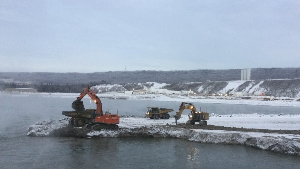
Another extensive excavation necessary for the Site C Clean Energy Project is the underwater work behind the dam. The area is approximately 600 meters by 200 meters and the goal is to excavate the area to a minimum line to ensure a smooth release from the spillway. The excess raw material removed from the river bottom is also essential to building the dam buttresses.
"We have to confirm the minimum line of excavation, but also we don't want to waste each excavator's time across the day shift and night shift," Prendergast explained. "Each operator needs to know where the previous excavator has excavated because they're all going in blind."
Each excavator is equipped with Trimble grade control technology. Prendergast continued, "With grade control technology, our operators can gather data like surveyors, a capability that has the potential to greatly improve our workflow."
The more conventional method of assuring that crews were achieving the minimum line would have been to perform a bathymetric survey. "Even if we had grade control technology on the machines, we were still limited to manual data transfer with USB sticks. WorksManager streamlined that process very quickly," he added.
Trimble WorksManager Software is the data hub enabling office-to-field communication via the internet that supports a complete, simple, and efficient technology enabled digital workflow. The three excavators' grade control systems continuously record positions throughout the day. At the end of a day's work, Prendergast logs directly into the machine via the WorksManager data hub, downloads the data and drops it into Trimble Business Center. Within Trimble Business Center, Prendergast compares the work completed that day to the 3D design. He confirms work is completed to below grade tolerance with the defined factor of safety, and then sends an updated perimeter model through WorksManager each morning to the operators.
And the operators love it. Prendergast said, "Their work progress is fluid, no stop and starts, or confusion about where to work; there's no downtime. If they have a question or have an issue with onsite conditions versus the map, I'm only a phone call away or we get on the WhatsApp group chat."
He's also able to report progress to the project management team through Trimble Business Center's reporting features.
Improving communication through combined technologies
Prendergast has also found ways to combine the old and the new technologies to further improve communication across the project. "We have a number of older systems such as Trimble TSC3 Controllers that work well for our purposes but aren't designed for 3D, which again creates disconnects in our workflow," he explained.
Undaunted, he looked for an app that could display terrain models in 3D and found Trimble SketchUp. Prendergast can put multiple 3D designs of specific areas of work into the application, with cross hatching to indicate work completed, in process, and to be done, and overlay those designs on a Google Earth map for location.
Compaction one of the newest streamlined spaces
One of the newest areas of work where technology has facilitated more streamlined workflows and enhanced communication is the compaction in the dam core.
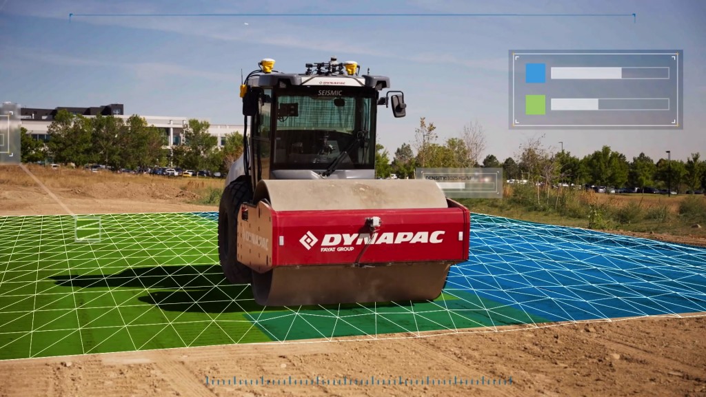
For this effort, 50-ton custom built packers are dragged around by bulldozers or tractor units in a set pattern. Engineering analysis found that compacting each area eight times produces the optimal density.
Prendergast added, "In this case, we have all the compactor units equipped with the Trimble GCS900 Compaction Control System linked to each other using just an ad hoc Wi-Fi connection - and WorksOS is the primary conduit for data sharing. The operators can see a colour-coded map on their cab screens that indicates red for the first pass, yellow for the second, etcetera, until the map goes green. The packers move up and down throughout the day until the assigned area is all green."
Compaction progress reports are generated in WorksOS for approval to move to the next section.
AR, aerial imagery and more
Like most large projects these days, the Site C Clean Energy Project team is also integrating drone data into its progress management, which required Prendergast to establish another connected workflow.
"The power of Trimble Business Center to facilitate large point cloud datasets gathered from a third party source really streamlines my job," he said. "The project managers are always looking for near real-time data to resolve issues as quickly as possible." He's looking forward to the day when WorksManager can facilitate drone imagery.
He's also thinking that augmented reality really is the way to the future - especially on equipment.
When asked about the value of a connected site on this project, Prendergast believes they are immeasurable. "It would be very easy to get behind on a project of this scope and scale. Seamless integration across products is essential to support streamlined workflows, near real-time data analysis, and sharing. Whether it's data from scanners, controllers, or equipment, everything is linked through a seamless integration; everything is connected. I can receive, model, send data, and create reports with ease, which has helped us keep this project on track."
The construction of the dam and generating station is progressing well. Crews completed the 800-metre-long roller-compacted-concrete buttress plus foundation in 2021, and are currently working on the earthfill dam above the riverbed. The project is currently on track to achieve the approved 2025 in-service date despite significant impacts from the pandemic.


